Randonnée Marche La Coulonche - La Coulonche Est et Ouest - Photo

La Coulonche Est et Ouest

 toporient
toporient

Utilisateur

© OpenStreetMap contributors
Longueur
Longueur
7,5 km
Altitude max
Altitude max
330 m
Dénivelé positif
Dénivelé positif
133 m
Km-Effort
Km-Effort  
9,3 km
Altitude min
Altitude min
242 m
Dénivelé négatif
Dénivelé négatif
130 m
Boucle
Boucle
Oui
Date de création :
2019-01-15 18:35:33.363
Dernière modification :
2019-05-01 13:30:04.356

(0 Avis)

Marche
Marche
2h00
Difficulté : Facile

Scannez ce code QR pour ouvrir la randonnée dans l'application SityTrail

Application GPS de randonnée GRATUITE

Logo SityTrail SityTrail

IGN / Instituts géographiques

Télécharger SityTrail sur l'App Store Télécharger SityTrail sur Google Play

Logo SityTrail SityTrail World

Le monde est à vous

Télécharger SityTrail sur l'App Store Télécharger SityTrail sur Google Play Télécharger SityTrail sur Huawei AppGallery

À propos

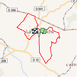
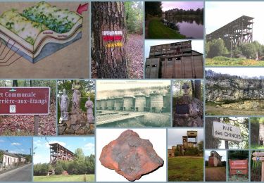
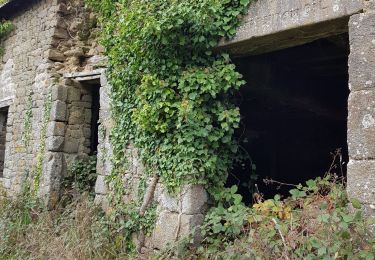
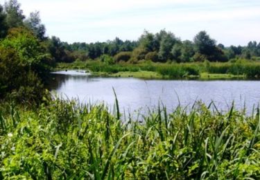
Randonnée Marche de 7,5 km à découvrir à Normandie, Orne, La Coulonche. Cette randonnée est proposée par toporient.

Description

Départ du parking du Stade à l'entrée sud de La Coulonche.
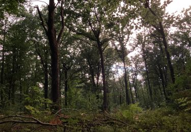
Nota : Le circuit court (4050m) partira du village, passera par Beau Soleil,Le Vivier, La Buatière, la Vieille Verrerie puis retour vers le village après passage en crête.

Profil altimétrique

Localisation

Pays :
France
Région :
Normandie
Département/Province :
Orne
Commune :
La Coulonche
Localité :
Unknown
Départ:(Dec)
Départ:(UTM)
687360 ; 5391141 (30U) N.

Randonnées à proximité

Randonnée Marche La Ferrière-aux-Étangs - Circuit of IRON by Yannick-p14-61 - Photo
Marche
yannick-p

Marche

Moyen
(1)
La Ferrière-aux-Étangs, Normandie, Orne, France
13,3 km | 16,5 km-effort
3h 35min
Oui
Randonnée Marche La Coulonche - La coulonche - Photo
Marche
Elisabeth Neveu

Marche

Très facile
La Coulonche, Normandie, Orne, France
3,7 km | 4,9 km-effort
1h 22min
Oui
Randonnée Marche Les Monts-d'Andaine - La Sauvagerie  - Photo
Marche
Elisabeth Neveu

Marche

Très facile
Les Monts-d'Andaine, Normandie, Orne, France
9,8 km | 11,6 km-effort
1h 31min
Non
Randonnée Marche Bellou-en-Houlme - Le marais du Grand Hazé - Bellou en Houlme - Photo
Marche
tracegps

Marche

Difficile
Bellou-en-Houlme, Normandie, Orne, France
18,2 km | 20 km-effort
4h 30min
Oui
Randonnée Marche La Ferrière-aux-Étangs - La Ferrière - La Ferrière aux Etangs - Photo
Marche
tracegps

Marche

Moyen
La Ferrière-aux-Étangs, Normandie, Orne, France
14,3 km | 17,9 km-effort
3h 4min
Oui
Randonnée Marche La Ferrière-aux-Étangs - 1h16 - Photo
Marche
Jeromefrando

Marche

Moyen
La Ferrière-aux-Étangs, Normandie, Orne, France
6,4 km | 8,5 km-effort
1h 16min
Oui
Randonnée Marche La Ferrière-aux-Étangs - La Feriere aux etant  - Photo
Marche
Elisabeth Neveu

Marche

Très facile
La Ferrière-aux-Étangs, Normandie, Orne, France
1,2 km | 1,3 km-effort
36min
Oui
Randonnée Marche La Coulonche - ballade nois de dieufit - Photo
Marche
ptimi

Marche

Facile
La Coulonche, Normandie, Orne, France
5,7 km | 6,8 km-effort
1h 59min
Oui
Randonnée Marche Les Monts-d'Andaine - La Sauvagère - Photo
Marche
tracegps

Marche

Moyen
Les Monts-d'Andaine, Normandie, Orne, France
9 km | 11 km-effort
2h 30min
Oui


Fermer
Mes abonnements